Enhancement of Observatory's Satellite Webpage with Himawari-8 Satellite Imageries
7 July 2015
From today onward, the Hong Kong Observatory will increase the update frequency of satellite imageries covering Asia on the Observatory's website from once an hour to once every half hour. At the same time, the Observatory's satellite webpage would be enhanced with the addition of deep convection weather satellite imageries where locations of possible thunderstorms and heavy rain are indicated.
The increase in update frequency of the satellite imageries covering Asia on the Observatory's website to provide more timely satellite imagery service to the public is made possible with the new geostationary meteorological satellite Himawari-8 launched and operated by the Japan Meteorological Agency which came into service on 7 July 2015.
Deep convection weather satellite imageries make use of satellite data from various channels to derive the locations of possible thunderstorms and heavy rain. Users could make use of these images to appreciate the development of heavy rain events over a large area and heighten the awareness of severe weather.
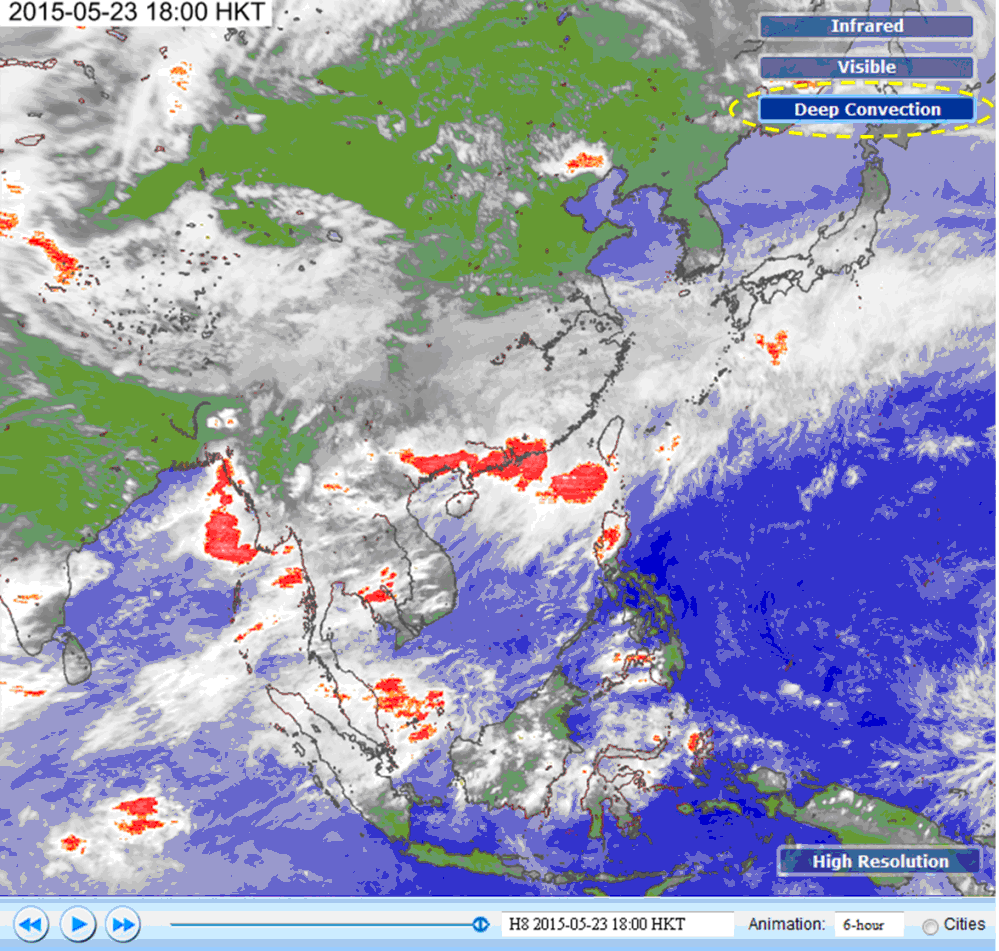
Figure 1 : On the deep convection weather satellite imagery on 23 May 2015, areas affected by deep convection weather are indicated in red. On that day, heavy rain affected the south China coastal areas where more than 70 millimetres of rainfall were recorded generally over Hong Kong with rainfall amounts exceeding 200 millimetres over Hong Kong Island.
URL of webpages:
English version:
http://www.hko.gov.hk/wxinfo/intersat/satellite/sate.htm
Chinese version:
http://www.hko.gov.hk/wxinfo/intersat/satellite/satc_uc.htm