Stratocumulus cloud in summertime
In Hong Kong, stratocumulus cloud is quite common during the cool season. But, it can also be observed in summertime, particularly when there is a low level temperature inversion associated with the sub-tropical high or a distant tropical cyclone.
There are several variants of stratocumulus but they all share the same characters. Firstly, they exist in the lower atmosphere of 2000 metres or below. Secondly, the depth of stratocumulus is quite limited as compared to its horizontal dimensions. Stratocumulus, being composed of water droplets, can be grayish or whitish and is quite often in the form of regularly arranged rolls or patches, with blue sky in between (figure 1).
On some occasions, stratocumulus may appear as elongated-shape clouds as shown in figure 2 which was taken at the dawn of 20 August 2008. Under the influence of the sub-tropical high, the weather was fine that morning and the atmosphere fairly stable. At the time of taking the photograph, the prevailing southerly winds were forced by a mountain range to rise above the lifting condensation level (LCL) and clouds formed. The clouds were no longer able to develop further upward when they encountered the temperature inversion at 450 metres (see the tephigram in figure 3), and therefore spread out horizontally to form elongated clouds.
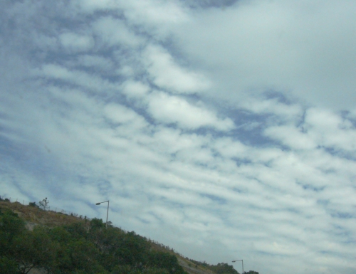
Figure 1. Stratocumulus clouds observed in Tsuen Wan around noon of 9 November 2008 (Photo: Courtesy of Mr. HUI Tai-wai).
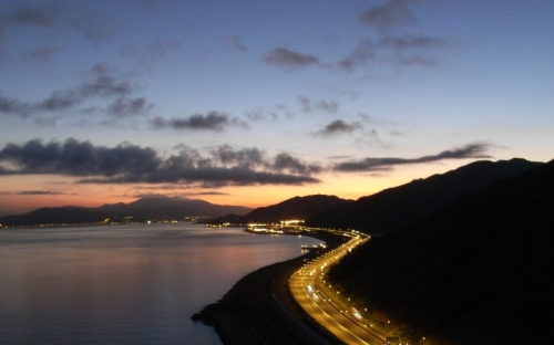
Figure 2. Stratocumulus clouds observed to the east of Tung Chung, Lantau Island on the early morning of 20 August 2008 (Photo: Courtesy of Mr. HUI Tai-wai).
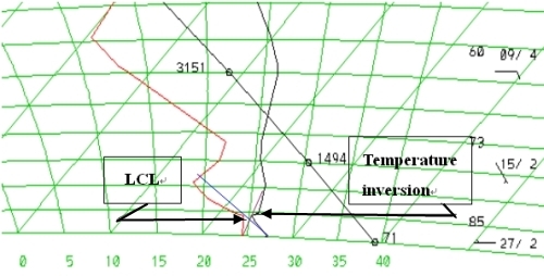
Figure 3. Tephigram of 00UTC, 20 August 2008. The lifting condensation level (LCL), corresponding to the height at which moisture of an air parcel will condense when being forced to move upward, was determined to be 320 metres.