Using Small Unmanned Aircraft for Meteorological Measurements
Using Small Unmanned Aircraft for Meteorological Measurements
LAM Ming-chun
September 2025
In recent years, the use of Small Unmanned Aircraft (SUA) for low-altitude operations (at or below about 300 feet above ground) has become increasingly popular. The Hong Kong Observatory (HKO) has also used SUA to conduct meteorological measurements.
Compared to traditional instruments, SUAs offer greater flexibility and are less constrained by terrain and environmental conditions. When mounted with meteorological sensors such as thermometers and anemometers, SUAs are ready to perform meteorological measurements (see Figure 1). Under safe and controlled conditions, pilots can remotely operate SUA to conduct vertical profiling, hovering or circular flights at specific altitudes to collect critical meteorological data including temperature, humidity, air pressure, wind speed and wind direction. This significantly increases the efficiency of atmospheric data collection.
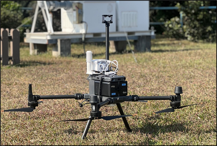
Figure 1 SUA mounted with meteorological instruments used by the HKO.
Over the past few months, the HKO conducted a number of tests using SUA for meteorological measurements. The results indicated that meteorological data collected by SUA such as temperature, humidity, wind speed and wind direction are consistent with those obtained from traditional instruments. In addition, the HKO has utilized the collected data for atmospheric scientific research.
In April 2025, the HKO conducted meteorological measurements using SUA in the vicinity of the Tolo Harbour in Tai Po. The SUA took off from Pak Shek Kok Promenade, flew across the Tolo Harbour to Ma On Shan Promenade and completed multiple round trips along this route (see Figure 2). The collected data not only enhanced understanding of terrain effect on meteorological situations but also aided in studying localized phenomena such as turbulence. When the SUA approached the coastlines of Pak Shek Kok and Ma On Shan, higher turbulent kinetic energy values were observed, but the values were lower when the SUA was flying over waters of the Tolo Harbour. This revealed that more turbulence activities occurred in the coastal areas and it is believed to be caused by terrain effects. The collected data were also used for comparison and validation with high-resolution numerical weather prediction model to improve the model’s forecasting accuracy.
The HKO will continue to leverage SUA technology to assist in low-altitude weather monitoring, conduct atmospheric observation missions in more areas across Hong Kong and collect meteorological data for analysis and research, for supporting weather forecasting and low-altitude economic activities.
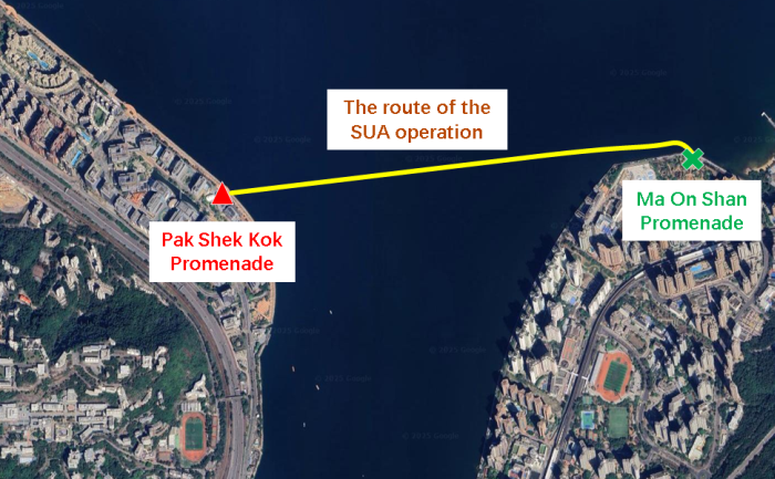
Figure 2 The SUA operation route conducted by the HKO in the vicinity of the Tolo Harbour in Tai Po in April 2025.