Artificial Intelligence Overlooks The Storm
Artificial Intelligence Overlooks the Storm
NG Yin-lam, Danice
March 2024
Significant convective weather such as thunderstorms will bring not only lightning and heavy showers, but can also bring squalls, turbulence and hailstones, affecting flight safety. Weather radar is a very effective tool for monitoring severe weather such as tropical cyclones, thunderstorms and heavy rain near Hong Kong (Figure 1).
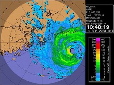
Figure 1 Radar image taken on 1 September 2023, showing Tropical Cyclone Saola in the vicinity of Hong Kong.
However, a radar could typically cover ranges up to 500 km only, while aviation users would need weather information over a much larger area. Therefore, there is a need to extend the area coverage of radar networks, in particular over the seas. Another useful tool for weather monitoring is the geostationary meteorological satellites that could provide continuous high-resolution optical image covering a large range of the Earth (Figure 2).
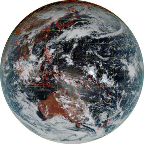
Figure 2 Satellite imagery taken at 02UTC on 22 November 2023 by the Himawari-9 geostationary meteorological satellite provided by Japan Meteorological Agency (JMA).
The HKO utilises artificial intelligence technique to simulate radar-like satellite image, namely the satellite-derived radar reflectivity. An artificial neural network (ANN) model (Figure 3) is developed on composite radar image over China to retrieve equivalent radar reflectivity from the Himawari-9 satellite data from JMA with a view to enhancing significant convection nowcasting services. HKO has also applied the same algorithm to GEO-KOMPSAT-2A (GK2A), the new generation geostationary meteorological satellite of the Korea Meteorological Administration (KMA) for even larger coverage of satellite-generated radar reflectivity (Figure 4).
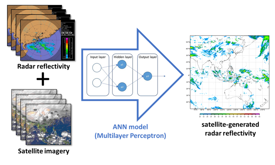
Figure 3 Utilising Artificial Neural Network (ANN) to generate large-area radar reflectivity.
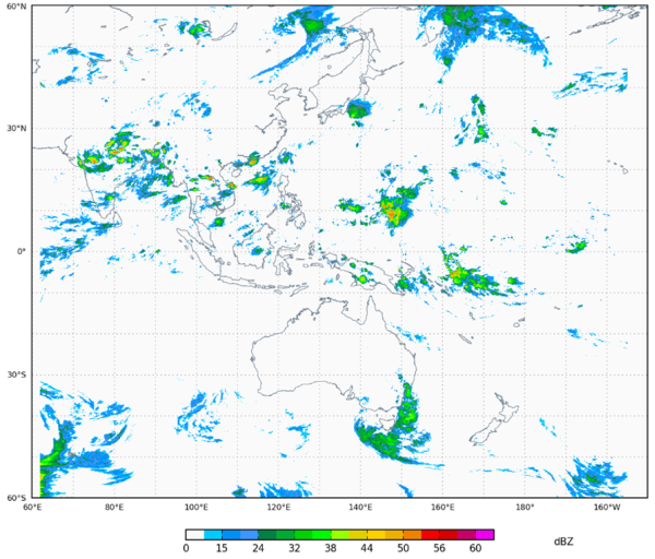
Figure 4 Combined satellite-generated radar reflectivity from Himawari-9 and GK2A satellites for 16 UTC on 7 September 2023.
In support of air traffic flow management, HKO also produces satellite-generated radar reflectivity images covering the Hong Kong Flight Information Region (FIR) (Figure 5) for reference by the Air Traffic Control Centre of the Civil Aviation Department, facilitating the air traffic controllers to understand the impact of severe convective weather on key areas over the FIR.
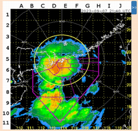
Figure 5 Satellite-generated radar reflectivity images provided by the Observatory for reference by air traffic controllers.