Cumulus - a play in the sky
Cumulus - a play in the sky
SING Yuen-ki
Cumulus
You may sometimes be surprised when you look up the sky, especially during summertime. The clouds lead you to boundless imagination. They are lumpy and ever-changing, sometimes like a sheep or a flying horse. These tricks are played out by cumulus clouds.
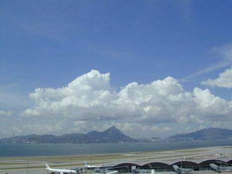
Cumulus belongs to the low cloud type. Cumulus clouds are very common in summer, forming at about 1000-3000 feet (i.e. 300-1000 metres) and in various shapes. They have various sizes and shapes. Their base is usually flat, but they can have towering tops. They are very bright under direct sunlight, but relatively dark elsewhere. When the weather is fine and the sky clear, they are just like cotton balls hanging in the sky, presenting a beautiful picture.
Altocumulus

Cumulonimbus
In a way, cumulus is also an elementary cloud, because it can change its character and become a different cloud according to the circumstances. When the atmosphere is moist and unstable, the air rises and causes cumulus clouds to further develop. With strong convection, they can develop into cumulonimbus clouds. Cumulonimbus is common in summer, sometimes bringing rain and thunder.
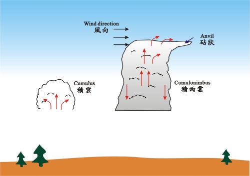
Development of cumulonimbus
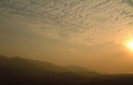
Cumulus is also a convective cloud by virtue of the strong upward current inside it. Especially in autumn and winter when the air is not so unstable, cumulus clouds may merge and cover a large part of the sky. They become altocumulus.
Cumulus clouds are active and restless in the sky. They play tricks with us, enlightening us with their various shapes. Next time when you look outside the window, see what inspiration they have in store for you.
References:
[1] 臺灣自然觀察圖鑑(32) - 雲與天氣,渡假出版社有限公司(1998) (in Chinese only)
[2] 雲的奧秘 - 台灣篇,人人出版股份有限公司(2002) (in Chinese only)
[1] 臺灣自然觀察圖鑑(32) - 雲與天氣,渡假出版社有限公司(1998) (in Chinese only)
[2] 雲的奧秘 - 台灣篇,人人出版股份有限公司(2002) (in Chinese only)