Cumulus Congestus Cloud
Cumulus Congestus Cloud
HUI Tai-wai
The rain season of Hong Kong normally spans from April to September, during which cumulus clouds are most frequently observed. A cumulus cloud looks like a cotton-ball with noticeable thickness and clearly defined edges, and can be associated with a wide range of weather. When the cloud is small and isolated, the weather is usually fine and sunny. If it develops into a “cumulus congestus cloud” with large vertical extent, there is a good chance of showers.
Cumulus congestus cloud, commonly known as “towering cumulus”, looks like a great castle and is usually in dazzling white against a background of deep blue sky. Towering cumulus, with a thickness of a few kilometers, can block most sunshine from reaching the ground, and may deliver showers to the areas underneath. Towering cumulus clouds are formed when humid air rises to a certain height, where moisture is cooled to form water droplets or ice crystals. The upward motion can be triggered by strong solar heating, convergence of air near the surface, or forced up-slope flow against hill-sides.
Figure 1 shows a towering cumulus cloud taken in the morning of 7 July 2003. Its cloud base i.e. the height of the lowest visible portion, was estimated at around 600 m above the ground. One can see that the base of the towering cumulus cloud is rather flat. Meteorologically speaking, the cloud base corresponds to a height called the “convective condensation level” at which moisture in a convective up-current condenses into water droplets. In the case under study, the observed cloud base was largely consistent with the convective condensation level (CCL) of about 600 m which was determined based on the surface air temperature of 29℃ and the tephigram (figure 2) recorded on that morning.
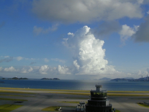
Figure 1. Towering cumulus clouds observed to the west of the Hong Kong International Airport on 7 July 2003.
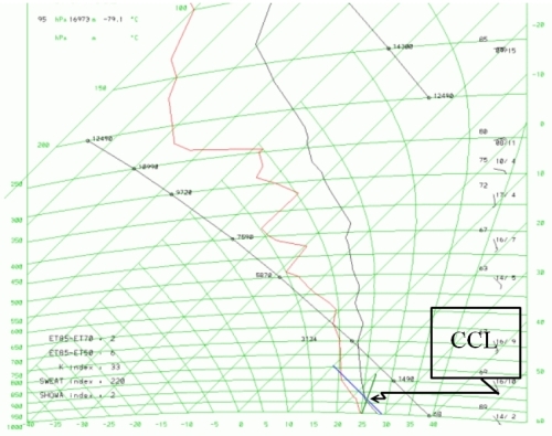
Figure 2. Tephigram of 00UTC, 7 July 2003.