Tracking by Satellite Observations
Tropical cyclones develop over the ocean and spend most of their lives over water. As conventional observations over the ocean are sparse, satellite analysis is by far the most important method in locating the centres of tropical cyclones.
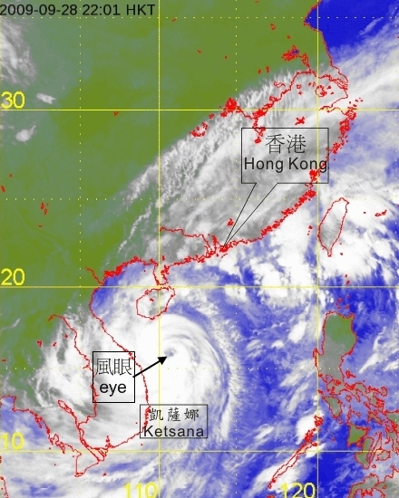
Figure 1. Infra-red satellite imagery at 11 p.m. on 28 September 2009 of Typhoon Ketsana. [The satellite imagery was originally captured by Multi-functional Transport Satellite-1R (MTSAT-1R) of Japan Meteorological Agency (JMA).]
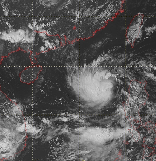
Figure 2. Visible satellite imagery at 2:30p.m on 9 September 2009 of Tropical Depression Mujigae. (Japan Meteorological Agency MTSAT-1R satellite image)
The appearance of a well-formed eye is a definitive indicator of where the tropical cyclone is (Figure 1). If an eye is absent, it is still possible to obtain a reasonable estimate of the centre by tracing the spiral rain bands of the storm (Figure 2) or by studying the relative motion of cloud features near its centre (Figure 3).
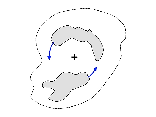
Figure 3. The relative rotating motion of clouds around the centre of a tropical cyclone (Northern Hemisphere)
Satellite pictures are now received at half-hourly intervals by the Hong Kong Observatory and form a near real-time observational basis for tracking tropical cyclones. Combining with other methods in locating the tropical cyclone, the centre of a tropical cyclone are plotted on weather map to show its movement (Figure 4).
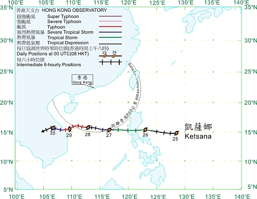
Figure 4. Track of Ketsana (0916) on 25 - 30 September 2009.