Profiling Rain Areas Using Radar
Profiling Rain Areas Using Radar
SO Chi-kuen
July 2015
Forms and appearances of clouds in the sky are always changing. The water droplets and ice inside a cloud may change with temperature, humidity and airflows, increasing or decreasing in quantity with water droplets freezing to form ice or ice melting to form water droplets. Moreover, the appearance of ice varies: in the form of crystals or ice pellets of various shapes. In severe convective weather, ice pellets can grow further to become hail. When the water droplets and ice become too heavy, they will fall to the ground as rain, snow or hail (Figure 1 shows ice in various shapes).
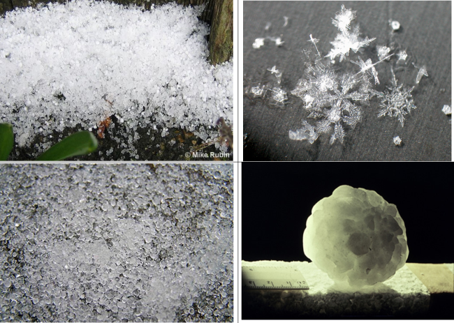
Figure 1 Ice in various shapes
Weather radar is an effective tool to detect rainfall. It transmits electromagnetic pulses into the atmosphere and measures the signals (echoes) reflected by water droplets or ice in a rain area. Location of the rain area can be determined from the time taken by the echoes returning back to the radar. For rainfall intensity, in general, stronger echoes (reflectivity) indicate heavier rainfall. However, as the reflectivity of ice is higher than that of water droplets, the estimated rainfall intensity may be higher than the actual intensity when there is ice in a rain area. Therefore, if we solely base on the echo intensity to estimate the composition of water and ice in a rain area or the rainfall intensity, there would be some limitations and uncertainties.
In 2015, the Observatory commissioned a new dual-polarization Doppler weather radar at Tate's Cairn (Figure 2). Unlike traditional single polarization (electric or magnetic field of electromagnetic wave varies on a single plane) radar, the new radar can transmit and receive electromagnetic pulses from both of the horizontal and vertical polarizations (Figure 3). Since the two polarized waves would give rise to echoes of varying characteristics when reflected by water droplets of different sizes or by different ice shapes, these characteristics can be analysed to determine the composition of rain areas as well as the rainfall intensity. For example, the shape of large water droplets is relatively flat compared to that of small droplets due to gravity. This results in stronger reflectivity for the horizontally polarized wave. Sometimes, insects and birds can also be distinguished from the dual-polarization echo signals. With these additional information, the new radar can more effectively monitor the development of hail, and more accurately estimate the rainfall intensity, opening a new chapter of weather radar’s applications in Hong Kong.
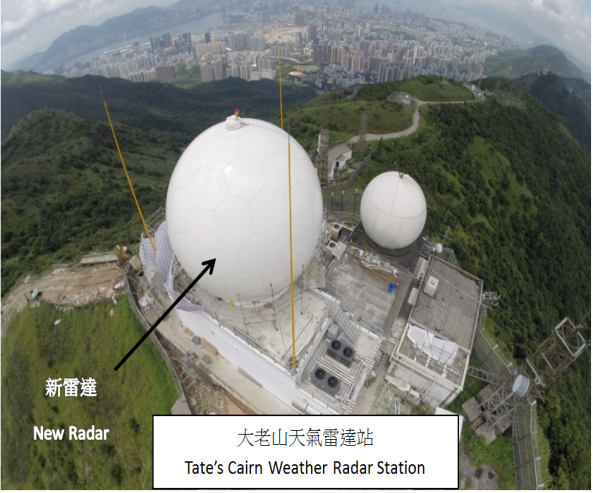
Figure 2 The Observatory commences operation of dual-polarization Doppler weather radar at Tate's Cairn in 2015
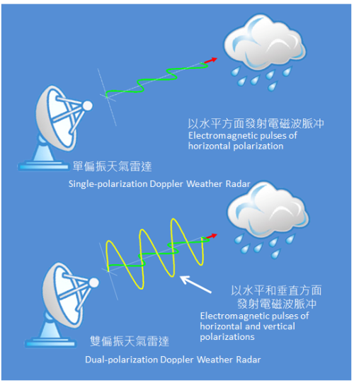
Figure 3 Working principal of single and dual-polarization Doppler Weather Radar
Figure 4 is an image captured by the radar at Tate's Cairn on 20 April 2015, showing rain areas with relatively large ice pellets (areas in yellow on the image) and hail (area in red on the image). Under the influence of a trough of low pressure, severe convective activities occurred over the coastal regions of Guangdong that day. Apart from squally thunderstorms and heavy rain, hail was reported in Shantou, which matched the location of hail shown on the radar image.
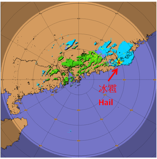
Figure 4 Image of automatic analysis from the Tate's Cairn weather radar at 5:17 pm HKT on 20 April 2015 indicating hail near Shantou (green = rain, blue = ice crystals (snow), yellow = ice pellets, red = hail)
The new weather radar at Tate's Cairn provides weather forecasters with "profiles" of rain areas. The information is useful to accurately monitor the development of rain areas and to estimate the rain intensity, contributing to timely issuance of severe weather warnings for safeguarding the general public.