|
Written by: LEUNG Wai-hung September 2010
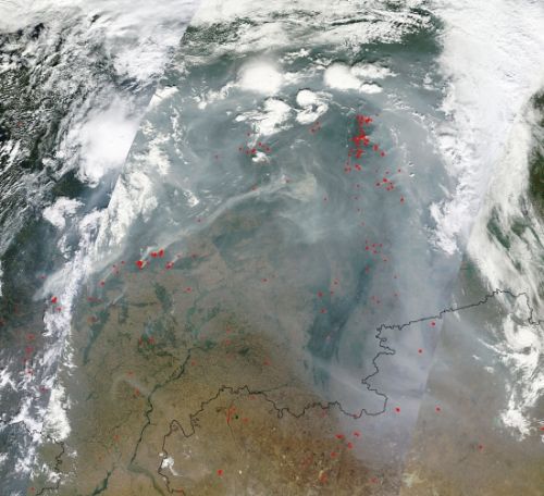
In July and August 2010, severe forest fires occurred in the western
part of Russia. Smoke from many fire sources over an
extensive area can be seen from the satellite picture (Figure 1).
In 1986, parts of the western Russia, Belarus and Ukraine were
contaminated by the fallout from the Chernobyl accident. If
the forest woods were burnt by the fires, radioactive materials might
be released into the atmosphere. According to the analysis of the
Institute of Radiological Protection and Nuclear Safety in France,
however, the polluted substances transferred from soil to woods have a
rather low level of radioactivity. It is expected that the
radioactivity arising from burning of the forest woods would be similar
to that of natural radon gas in the air. Therefore, the fires
would not pose any radioactive hazard to the residents
nearby. Nevertheless, it should be noted that the toxic smoke
and particulates produced by the fires were harmful to health.
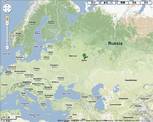
Besides, people were concerned about whether the nuclear facilities in
Russia would be affected by the forest fires. The fires had once raged
near Savor, a town in western Russia with major nuclear research
facilities (Figure 2). According to media reports, Russian officials
said that Sarov was not affected by the fires and all explosives and
radioactive substances had been temporarily removed from the
town. An 8-kilometre trench was also dug by the Russian army
to prevent the fires spreading to Sarov.
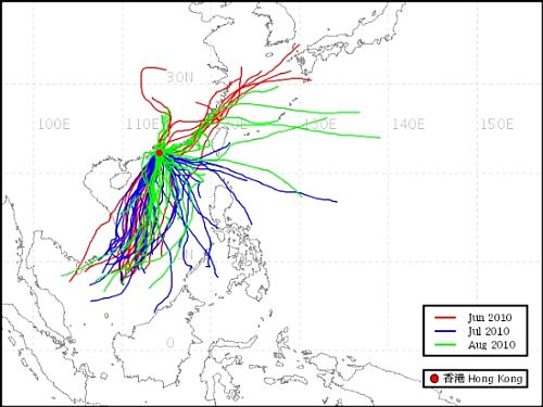
Readers may be interested to know whether the particulates released by
the Russian forest fires pose any threats to Hong Kong. The
location of the fires was more than 6000 kilometres northwest of Hong
Kong. Figure 3 shows the trajectories of air reaching Hong
Kong from June to August 2010. As there was no air mass coming from the
northwest during the period, Hong Kong was not affected by the
particulates.

Figure 1 Satellite picture showing smoke from a number of
fire sources over the western part of Russia. The red spots
in the picture depicted suspected locations of the fire. (Source of
image: NASA/GSFC, MODIS Rapid Response System,
http://rapidfire.sci.gsfc.nasa.gov/gallery/, image time: 11 August
2010, 09:25UTC/17:25HKT)

Figure 2 Map showing location of Sarov and the western part
of Russia. (Source of image: Google Maps)

Figure 3 Backward trajectory of air mass reaching Hong Kong
from June to August 2010
References:
- "MODIS
Rapid Response System", Goddard Space Flight
Center, NASA.
- Institut De Radioprotection Et De Suret?
Nucl?aire (Institute of Radiological Protection and Nuclear
Safety), France.
- CNN World News.
- BBC News.
 Back to content
|


 Back to content