Satellite image is an indispensable tool for monitoring weather over a wide area. In particular, it provides valuable weather data over the sea where there is a lack of fixed weather observation stations. Nowadays, meteorological satellites generally have different sensors for detecting multiple channels of the electromagnetic spectrum. The most common channels in use are the visible and infra-red channels.
Visible channel sensor receives reflected sunlight from the ground surface and cloud top, just like taking pictures of the Earth from space. While visible satellite images require sunlight and are only available in daytime, they have a higher resolution and can display finer details of cloud structures which help to analyse the weather situation (Figure 1).
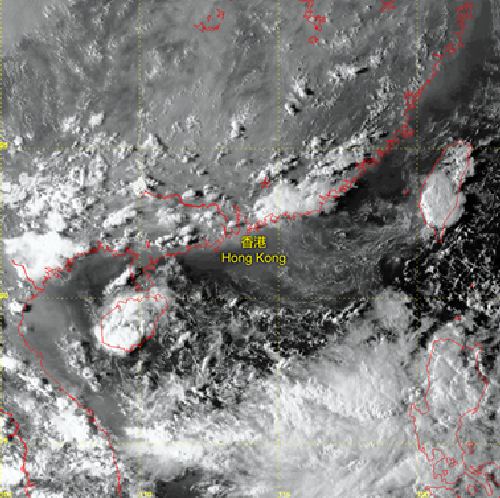
| Figure 1 | Visible satellite image at 16:32 HKT on 15 Sep 2013. Cumulonimbus clouds developed over the coastal areas of southern China. |
Infra-red channel sensors receive thermal radiation emitted from the ground surface and clouds. Through analysis of the amount of thermal radiation received, temperatures of the targets under observation (like clouds) can be estimated. As temperature usually decreases with height in the troposphere, high clouds generally have a lower temperature. Therefore, infra-red satellite images can be utilized for distinguishing the differences of cloud top layers and analysing deep convection and intensity of tropical cyclones (Figure 2).
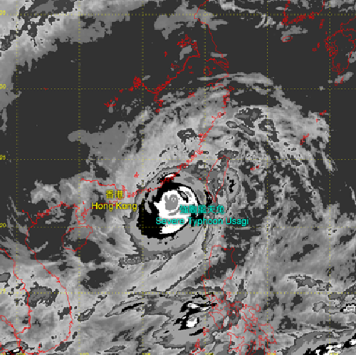
| Figure 2 | Enhanced infra-red satellite image at 09:32 HKT on 22 Sep 2013 for D'vorak analysis of tropical cyclone intensity. |
Infra-red sensing can be split into multiple narrower channels according to wavelength. As different atmospheric constituents, such as moisture and dust, are absorbed or reflected by infra-red radiation of different wavelengths at separate rates, subtle weather features such as sand, dust and ash (Figure 3), or deep convection weather (Figure 4) can be portrayed through analysis of the data from these infra-red channels. Four infra-red channels are now available on the Chinese Fengyun-2 series and Japanese MTSAT satellites. The next generation of satellites, Fengyun-4 series of China and Himawari series of Japan, will be equipped with more infra-red channels, providing even more atmospheric data which will aid a more comprehensive and accurate analysis of weather situations.
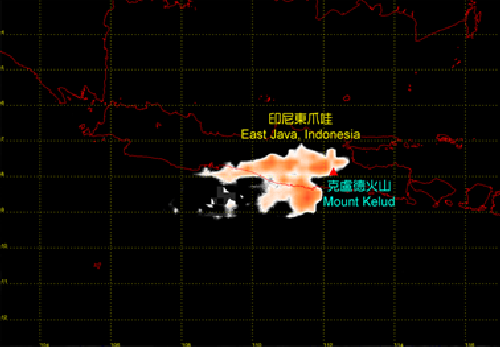
| Figure 3 | Satellite image at 13:32 HKT on 14 Feb 2014 generated by using a combination of infra-red channels suitable for detection of sand and dust. Large amount of volcanic ash (orange region) was released by volcano Mount Kelud in East Java of Indonesia. |
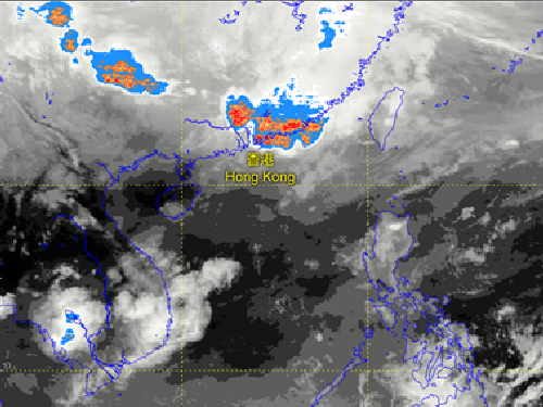
| Figure 4 | Satellite image at 21:32 HKT on 30 Mar 2014 generated by a combination of infra-red channels suitable for detection of deep convection. Deep convection (orange and red regions) was affecting Hong Kong and its vicinity at the time. |
