| Type |
Appearance and Formation |
Favourable Conditions in Hong Kong |
| Frost |
Small ice crystals formed directly from deposition of water vapour in the ambient air onto cold surfaces at or below the freezing point of water without going through the liquid state.
There are different variants of frost, such as ground frost, advection frost, frost flowers, etc., depending on how it forms and its appearance.
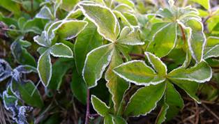
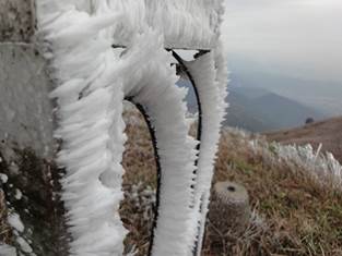
Frost at Ta Kwu Ling on 29 December 2013. (Photo courtesy of Irwin Wong)
|
In Hong Kong, frost usually occurs when there is no rain and the weather is dry. The state of sky may vary from clear to overcast. Winds are usually from north to northeast with strength varying from light to moderate.
Geographically, frost usually occurs on:
(i) low-lying grounds in the northern part of the New Territories, usually spatially localized; and
(ii) high grounds, such as Tai Mo Shan and Lantau Peak, and may be widespread.
For type (i), ground frost usually forms on very dry nights with clear sky and light to calm winds, conditions that favour enhanced nocturnal radiation cooling.
|
| Ice/freezing rain |
Transparent or translucent solid ice, formed when liquid water is exposed to ambient air with temperature at or below the freezing point of water.
Moreover, under favourable atmospheric conditions, melted snowflakes or rain may fall in liquid form through a shallow sub-freezing layer near the ground which is too thin to allow the super-cooled raindrops (freezing rain) to refreeze before they come into contact with cold objects, forming icicles or ice film.
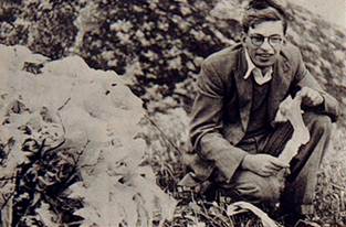
Ice on Tai Mo Shan in 1970s
|
In most cases in the past, icing was reported on very cold days on hill tops with zero or sub-zero temperatures. It may appear in the form of icicles or ice sheets in fish ponds, water tanks or buckets, as well as pools of water. |
| Rime |
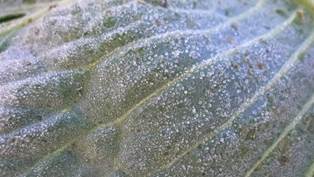
Rough ice crystals with feather-like appearance, formed when tiny, super-cooled water droplets in fog or cloud on mountains come into contact with objects at or below the freezing point of water. The rime “feather” can grow thick on the windward side of the objects.
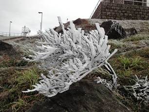
Rime on Tai Mo Shan on 16 December 2010
|
A rare phenomenon with only five days of occurrence in Hong Kong since 1948, and in all cases found on hill tops at sub-zero temperatures, enshrouded in low stratus clouds with fog or drizzle. |
| Sleet |
No internationally agreed definition for sleet at the moment. Generally speaking, sleet refers to "mix of rain and snow (in Britain and Australia) or ice pellets (in America)".
Sleet occurs in stratus clouds where snowflakes partially melt as they fall through a layer of relatively warm air (above freezing point) and then re-freeze into ice pellets in a colder layer close to the ground.
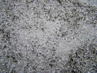
Sleet (small ice pellets) on ground in US
(http://en.wikipedia.org/wiki/Ice_pellets)
|
A rare phenomenon in Hong Kong with only five days of occurrence and mainly on hill tops. |
| Snow |
Tiny ice crystals stuck together to become snowflakes with fluffy appearance, formed when tiny super-cooled cloud droplets freeze at temperatures well below the freezing point of water, usually only attainable high up in the atmosphere.
For snowfall, usually the layer of air from ground to where snow is formed has to be at or below 0oC all the way, so that the snowflakes do not melt into rain before reaching the ground.
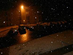
Snow in Washington, D.C. area on 17 March 2014 (Courtesy of K Y Kong)
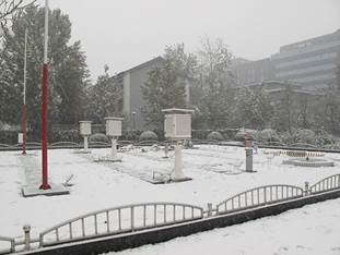
Snow in Beijing on 12 November 2009
(Courtesy of T C Lee)
|
Extremely rare phenomenon with only four reports since 1948 (one at Cape Collinson and three at Tai Mo Shan near its summit), all described as brief and slight snow and three of them with above freezing surface temperatures at the observation spot. |