Survey on New Significant Weather Charts for Flight Documentation
|
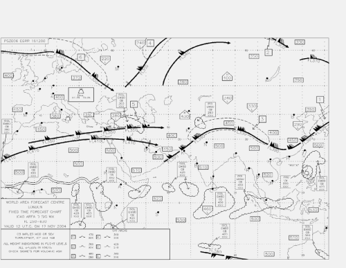
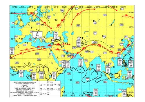
To speed up the transmission of significant en-route weather data, the World Area Forecast Centre (WAFC) at London had started disseminating significant weather forecasts in digital format. Weather charts generated from these digital forecasts will replace the current charts (in T4 fax format) in mid-2005 in accordance with ICAO's transition plan for the World Area Forecast System (WAFS). New significant weather charts produced by the Hong Kong Observatory from these digital forecasts have been made available on a trial basis through the Observatory's web-based Aviation Meteorological Information Dissemination System (AMIDS) since 30 September 2004. The use of the digital WAFS data would enable tailoring of the forecast charts according to user's needs. For instance, significant weather charts can be presented in colours and the chart areas and map projection can be customized to suit the airline's operation.
Figure 1. Existing Significant Weather Chart in T4 Fax Format
Figure 2. New Significant Weather Chart The purpose of this survey is to invite feedback from airlines and pilots on the new significant weather charts so that further tailoring and adjustments could be made prior to their full operational use. Specifically, the survey is focused on the following areas : Please fill in the questionnaire and press 'submit' button at the end of the questionnaire; or Download and fill in the questionnaire and return to the Hong Kong Observatory by fax ([852] 2375 2645). The deadline for submitting returns is 15 December 2004. |