New weather charts ready to be launched
|
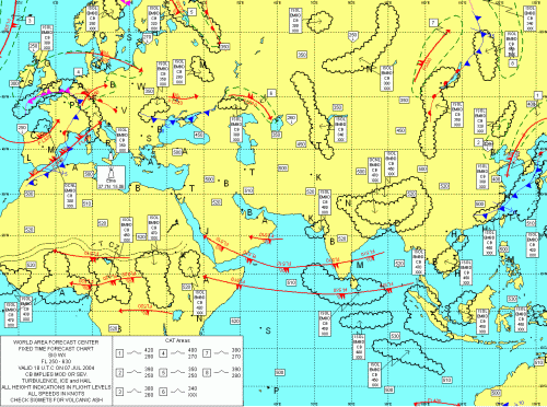
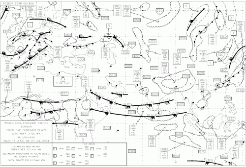
The provision of forecast charts of en-route significant weather to departing flights in Hong Kong will soon enter into a new digital era. Weather charts generated from digitally coded data will shortly be introduced for trial use by airlines and pilots on the Observatory's web-based Aviation Meteorological Information Dissemination System (AMIDS). An example of the digitally generated weather chart is shown in Figure 1. From data provided by the two World Area Forecast Centres at London and Washington, weather charts could now be tailored according to user's needs. For example, in addition to standard areas, charts for specific flight routes could be provided. Furthermore, the "look and feel" of the charts, such as font sizes, colours, map projections could be adjusted and fine tuned to enhance their user-friendliness compared with the existing fixed-area facsimile charts (Figure 2). These facsimile charts have been used by the aviation community in the past few decades. Over the next few months, airlines and pilots using the new weather charts will be invited to provide feedback to the Observatory on their quality so that further tuning and adjustments could be made prior to full operational use. |
Figure 1. Digitally generated significant weather chart
Figure 2. Significant weather chart in facsimile format |