Skip Content

GFS Turbulence Measurement

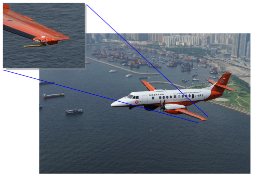
To further enhance the turbulence alerting service, the Observatory collaborated with the Government Flying Service (GFS) to collect high quality turbulence measurements in the vicinity of the HKIA.

Turbulence measurements are made by a GFS fixed-wing aircraft.  A data probe was mounted externally under one of the aircraft wings (Figure 1). The aircraft collects meteorological data including wind speed and direction in the vicinity of the HKIA three times a week regularly. These data can be considered as 'sky truth' because of their high quality and high precision.  Eddy Dissipation Rate (EDR), an internationally adopted metric of turbulence intensity, is derived from the data and compared against that measured by the Observatory's LIght Detection and Ranging (LIDAR) system. Study results showed that the EDR from the GFS aircraft matched well with those from the LIDAR (Figure 2). The Observatory will make use of the data to develop a LIDAR-based EDR products for turbulence alerting. 


 A GFS fixed wing aircraft with a data probe mounted on the wing tip collects meteorological data in the vicinity of the HKIA regularly

Figure 1  A GFS fixed wing aircraft with a data probe mounted on the wing tip collects meteorological data in the vicinity of the HKIA regularly


EDR profiles from data collected by the GFS aircraft compared with those from the LIDAR 

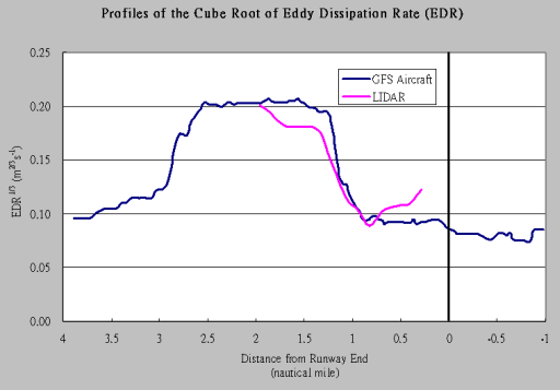
Figure 2  EDR profiles from data collected by the GFS aircraft compared with those from the LIDAR