Significant Convection Forecast for the Arrival and Departure Corridors
|
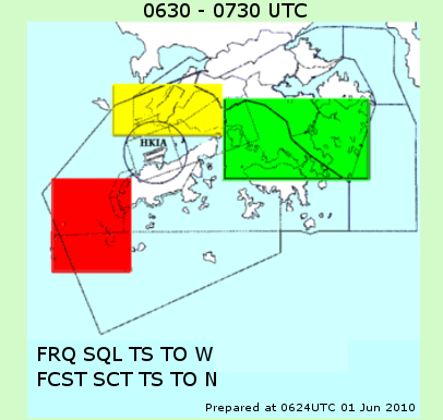
In support of the air traffic management by ATC especially in severe weather situations, 1-hour forecast of significant convection over strategic areas for the arrival, departure and missed approach flights in Hong Kong (marked areas to the east, west and north of HKIA in Fig.1) has been provided to ATC for trial use via the integrated webpage for 'Significant Convection Monitoring and Forecast' on the AMIDS since August. The forecast is presented in pictorial and text format (Fig.1). The text messages will be given below the pictorial display if significant convection is forecast over any marked areas. To facilitate input to ATIS by ATC when situation warrants, abbreviated plain language are used in the text forecast. There are three levels of color coding and their meanings are:
|
|
Figure 1 Sample graphical and text display of significant convection forecast over the arrival and departure corridors of HKIA for the next hour. The circle marks the aerodrome area (8 km from ARP). |