Wave Clouds near Hong Kong International Airport
|
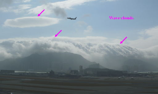
Wave clouds may form when moist air flows over a mountain. The formation of these clouds is associated with the condensation of water vapour in the air as the air blows up the mountain top. On the morning of 22 February 2009, fresh to strong southeasterly winds from the southern side of Lantau climbed over the Sunset Peak and Yi Tung Shan and then flowed down the northern slope towards the Hong Kong International Airport (HKIA). Wave clouds were seen covering the range of mountains with some of them even appeared like a waterfall pouring down towards the airport. The presence of wave clouds is an indication of the existence of relatively large vertical air movements over and around the mountains and these vertical movements can induce windshear and turbulence over the HKIA which is at the lee side of these mountains. As a matter of fact, the Airport Meteorological Office received 16 windshear reports from pilots in that morning. |
Figure 1 Wave clouds appearing like a waterfall formed over the downwind side of the range of mountains to the southeast of the HKIA on the morning of 22 February 2009.
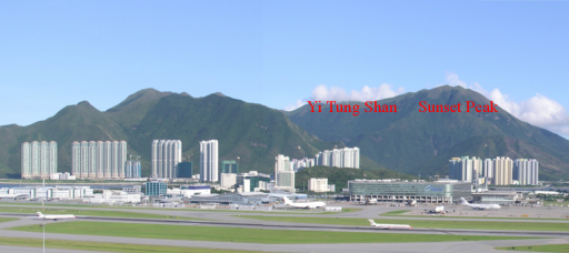
Figure 2 A photo taken on a fine day, with the same viewing angle as in Figure 1, showing both the Sunset Peak and Yi Tung Shan which were covered in clouds in Figure 1. |