Microwave Radiometer Working at the Airport
|
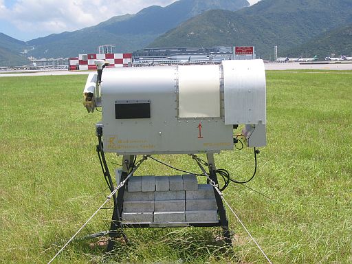
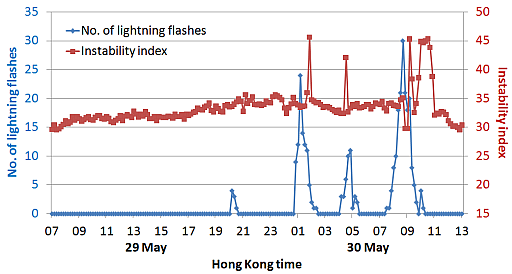
A newly acquired microwave radiometer (Figure 1) began its operation at the airport in late May this year. The instrument measures the microwave radiation emitted from the oxygen molecules and water vapour in the air and, with the use of statistical methods, determines the temperature and humidity profiles of the atmosphere from the ground up to 10 km aloft. Such profiles are also obtainable from the conventional upper-air measurements using balloons, which are available normally twice a day. For the radiometer, measurements are made once every several minutes. This greatly enhances the monitoring of upper-air temperatures and humidity, and facilitates the forecasting of windshear, thunderstorms and low-visibility weather. Figure 2 shows an example where atmospheric instability index (K index) is derived from the radiometer data for forecasting the occurrence of thunderstorms. During the daytime of 29 May 2008, the atmosphere became more humid and unstable. This was indicated by an increase in the instability index (red dots) derived from the data that rose to relatively high level (about 35). This favours the development of thunderstorms. In fact, lightning activity appeared that night (blue dots) and persisted until the morning of the next day. In this period, the instability index remained at rather high level. It is not until around noon time of 30 May that the instability index dropped to lower values (about 30) and the lightning activity abated. |
Fig.1: The microwave radiometer operating at the airport.
Fig.2: The time series of instability index (K index) as derived from the radiometer, and the number of lightning flashes recorded within 20 km from the radiometer. |