Customized Upper Wind and Temperature Forecast Charts
|
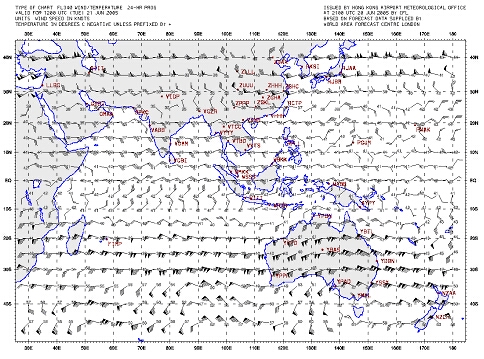
In accordance with the International Civil Aviation Organization (ICAO) transition plan for the World Area Forecast System (WAFS), the production of wind/temperature forecasts in fax chart format by the World Area Forecast Centres (WAFCs) London and Washington would cease on 1 July 2005. In their place, wind/temperature charts would be generated exclusively from digital WAFS data provided by the WAFCs. With effect from 21 June 2005, the Observatory started providing the wind/temperature forecasts generated from the digital WAFS data in flight documentation supplied on the AMIDS. An example of the new upper wind/temperature forecast chart is shown below. The new format enables customization of flight documents to be made, such as user-defined areas and the display of aerodromes on the charts. |
An example of the upper wind/temperature forecast plotted from WAFS digital data |