New radar images on AMIDS
|
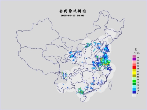
To facilitate users to better appreciate the weather situation over China, the China Composite Radar images, provided by the China Meteorological Administration (CMA), have been made available on AMIDS. The hourly images show the radar reflectivity (from which the rainfall rate could be estimated) of the rain echoes as measured by the radar network over China. An animation of the images for the past 24 hours is also available to enable users to appreciate the movement and development of rain areas (Fig. 1). |
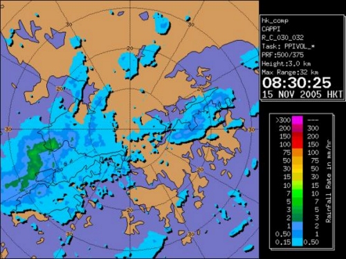
Fig. 1 China composite radar image showing an extensive rain area over eastern China. To address suggestions raised by members of the Liaison Group on Weather Information for General Aviation, 32-km radar images have been made available on AMIDS. The images provide an enlarged view of the radar echoes within Hong Kong which would be particularly useful to the local aviation in avoiding severe weather especially thunderstorms (Fig. 2).
Fig. 2 32-km radar image at 08:30 a.m. on 15 November 2005 showing a rain area crossing Hong Kong |