Changes in coding of Thunderstorm SIGMET to reduce over-warning
HKO News Bulletin for the Aviation Community (35th Issue)
The use "polygon" to define the warning area in thunderstorm SIGMET was adopted by the Airport Meteorology Office as the preferred method starting last April as this coding method can describe the convective area more precisely when compared with other syntax like "sector" or "segment". The use of polygon will also facilitate the graphical presentation of SIGMET in EFB and future transition to extensible markup language (XML)/geography markup language (GML).
Under the "polygon" representation, the thunderstorm storm area will be enclosed by at most 7 geographic points identified by latitude and longitude.
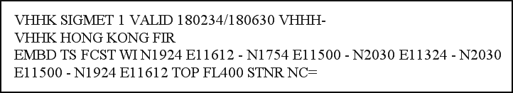
Figure 1: A real sample on the morning of 18 May 2016.
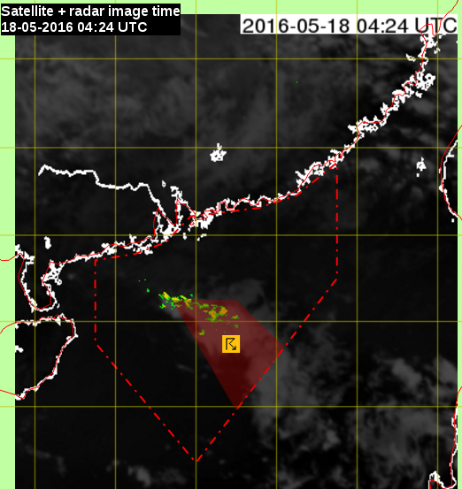
Figure 2: The corresponding graphical SIGMET for the sample in figure 1.