Recent updates on the Aviation Thunderstorm Nowcasting System (ATNS)
HKO News Bulletin for the Aviation Community (35th Issue)
ATNS is a nowcasting system tailored for aviation. It provides forecast of radar echoes at 6 minute time steps for the next 1 hour, and it is updated rapidly at 6 minutes. It will also highlight when a significant part of the air space is being or is expected to be affected by convection. The design goal of the system is to assist with the tactical decision making for ATC. In response to user's request and to facilitate future development, a number of changes were made:
i) arrival/departure routes has been updated with new waypoints added to support departure routes, and obsolete waypoints removed;
ii) the alerting thresholds for (amber/red) were updated to be more relevant to impact;
iii) the frontend has been reconfigured and is sub-divided into the 4 runway configurations. i.e. 07ARR, 07DEP, 25ARR, 25DEP, each with its own setting of routes and waypoints so that only the most relevant information is displayed.
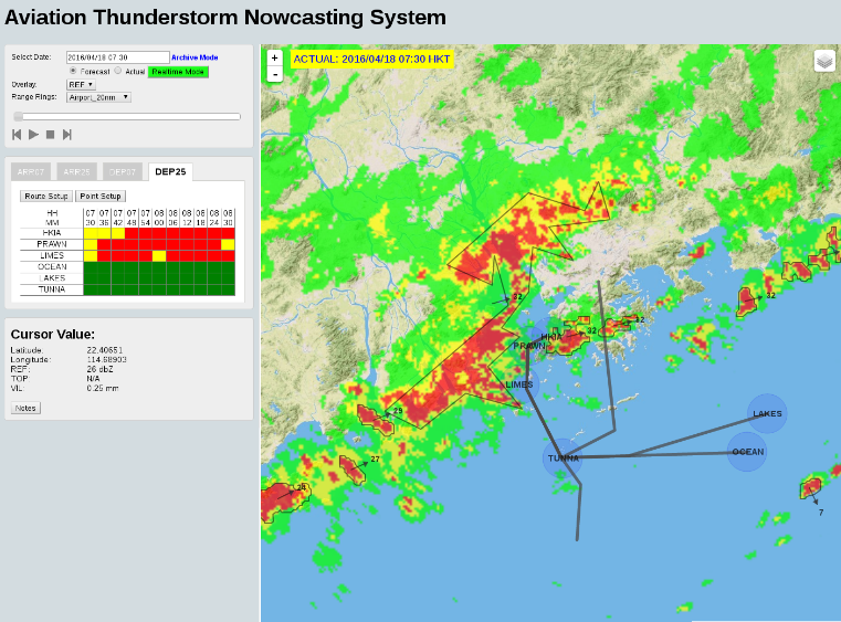
Figure 1: The new ATNS frontend was built by more modern WEB and GIS technology.