Skip Content

Windshear and Turbulence on 5 March 2015

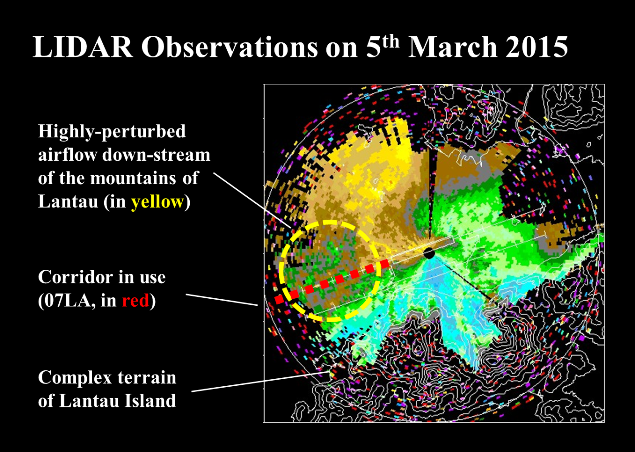
The arrival of an intense, late-season northeast monsoon on 5 March 2015 resulted in 64 reports of significant windshear by landing/departing aircraft at the Hong Kong International Airport (HKIA), the highest number received by the Observatory within a day in recent years under non-tropical cyclone situations.

The southeasterly jet, undercut by a shallow layer of surface easterlies, created the “perfect” set up for highly-disturbed airflow over the western corridors immediately downstream of the mountains. The resulting small-scale, fast-evolving wind features, which would be easily encountered by landing aircraft at 07LA on that day, were well captured by the Observatory’s Light Detection And Ranging (LIDAR) systems (as shown below). While all 64 encounters were covered by the Observatory’s windshear and turbulence alerting service, a number of affected aircraft had to initiate go-around or even diversion to neighbouring airports.


Fig. 1 Terrain-induced windshear features over the western corridors of HKIA in the afternoon of 5 March 2015 as revealed by LIDAR planar scan. During this hour, nine aircrafts reported encountering significant windshear when landing at 07LA.