Skip Content

Field Study of Short-range LIDAR in 2013

The Observatory has always taken a pro-active approach in exploring the application of latest technologies in improving the windshear and turbulence alerting services at the Hong Kong International Airport (HKIA). Over the past few summer seasons, trial use of a short-range LIDAR (SRL) has been arranged on the rooftop of the AsiaWorld-Expo to test the possibility of enhancing windshear alerting over the eastern approach of the North Runway (i.e. corridor 25RA).

The field study continued in 2013. Taking advantage of the improved spatial resolution due to recent technological advancements (30 m in 2013 as compared to 75 m in previous field studies and 105 m of the existing long-range LIDARs), the SRL is capable of scanning at a revisit time of 20 seconds (1-2 minutes for existing long-range LIDARs) over a wider angle while revealing finer details, allowing detection of fast-evolving, micro-scale flow features associated with building/man-made structures (Fig. 1). A new algorithm has also been developed based on the enhanced scanning capabilities which indicated comparable performance with the existing Windshear and Turbulence Warning System (WTWS) during the 2013 study period (July-August, 5 weeks) as well as ability to enhance automatic windshear alerting over 25RA based on data from the 2012 field study.

The Observatory intends to submit funding application for permanent installation of an SRL at HKIA in the coming financial year and would actively solicit users' views on alerting strategy as well as phraseology using the SRL.


Fast-evolving flow features as revealed in a sequence of SRL scans.  Warm colours represent velocities away from the SRL (center of each snapshot).  Successive images are separated by 40-second intervals, suggesting a duration of less than 2 minutes for the event  a concurrent windshear report was received over 25RA at an altitude of 200 feet. 

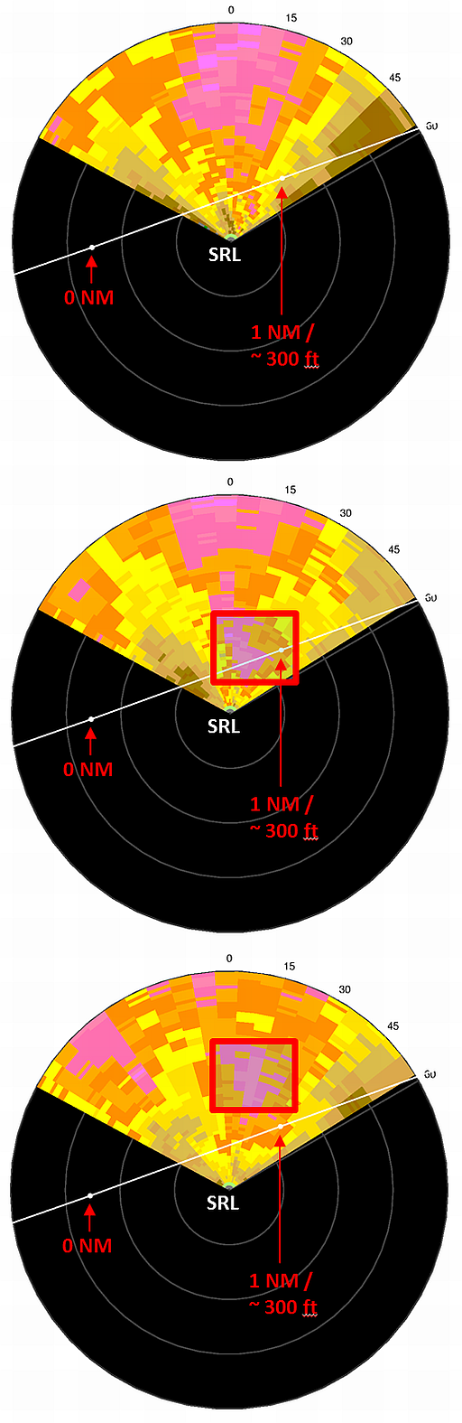
Figure 1  Fast-evolving flow features as revealed in a sequence of SRL scans. Warm colours represent velocities away from the SRL (center of each snapshot). Successive images are separated by 40-second intervals, suggesting a duration of less than 2 minutes for the event a concurrent windshear report was received over 25RA at an altitude of 200 feet.