Forecast Space Cross Section Chart
|
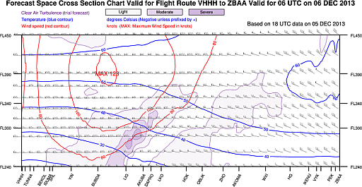
A new set of forecast space cross section charts for routes to and from Beijing, Shanghai and Fukuoka is now available on AMIDS. The forecast charts are prepared based on Hong Kong Observatory mesoscale numerical weather prediction model data and include the following information along selected flight routes:
|
|
Figure 1 An example of forecast space cross section chart from Hong Kong to Beijing valid for 06 UTC on 6 December 2013.
|