A Virtual Tour to The World's First LIDAR at The Airport
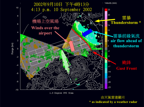
...... The following is an example. In the afternoon of 10 September 2002, thunderstorms affected areas 15 kilometers to the northeast of the airport. On the LIDAR image, the high winds that came ahead of the thunderstorm (indicated by a deep blue arrow) were clearly discernible. The front edge of the high winds is called 'gust front'. An aircraft reported encounter of windshear while landing on the airport that afternoon, apparently having flown across the gust front. |
 |
 |
 |
 |
 |