Addition of Po Toi Water Level Data on Coastal Sea Level (Trial) Webpage
24 June 2026
The Hong Kong Observatory added the measured and forecast water level data for Po Toi to its Coastal Sea Level (Trial) webpage today (24 June 2026) to further enhance its tidal information service. Following the devastation of Waglan Island tide station and related facilities during the strike of Super Typhoon Ragasa in September 2025, the HKO installed a temporary tide gauge at the Po Toi Public Pier in March this year to strengthen monitoring of sea level at the southeastern tip of Hong Kong. In addition to providing real-time water levels updated every five minutes, the webpage also displays total water level forecast for the next 12 hours. The water level data for Po Toi will also be added to “Astronomy & Tide Information” in the “MyObservatory” mobile app in a future update.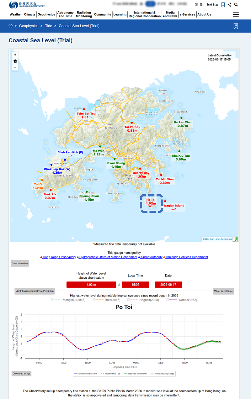
Layout of Po Toi water level data display on the webpage for Coastal Sea Level (Trial) after clicking on the corresponding tide station (marked in the blue box) on the GIS-based map.