HKO enhances its radar and satellite imagery services
31 March 2025
The Observatory further enhances its radar and satellite imagery services on the HKO website today (31 March 2025). The update frequency of radar images covering the 128 km and 256 km ranges has increased from 12 minutes to every 6 minutes. In addition to the rainfall rate imagery at 3 km above sea level for the 64 km range, new imagery at a height of 2 km is added (Figure 1), allowing the public to better grasp the rainfall situation in the lower atmosphere. Furthermore, the update frequency of the Fengyun-4B satellite images covering western Asia has increased from hourly to every 15 minutes (Figure 2). “All-day Visible” satellite imagery (Figure 3), and aerosol optical depth imagery from the Republic of Korea's GK-2B satellite (Figure 4) are also introduced to enhance the monitoring of weather and visibility conditions over southern China and the northern part of the South China Sea. The enhanced radar and satellite imagery services will be launched successively in subsequent updates of the “MyObservatory” mobile application.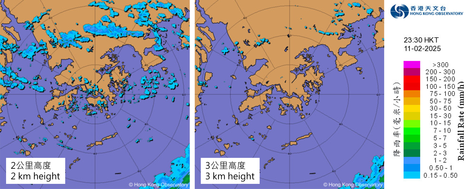
Fig. 1 Weather radar images on the evening of 11 February 2025. Image at 2 km above sea level (left) displays more radar echoes compared to the 3 km height image (right), providing a clearer representation of rain area development in the lower atmosphere.
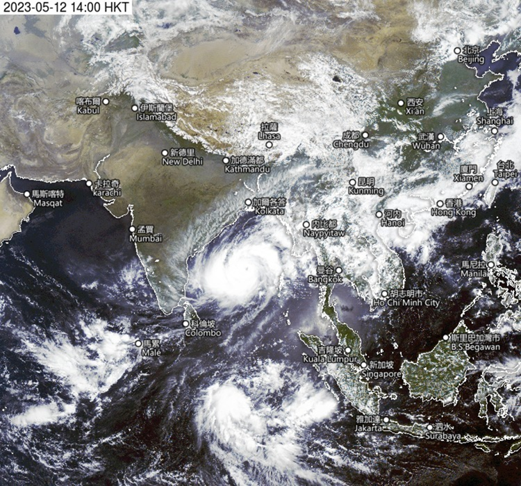
Fig. 2 The update frequency of Fengyun-4B satellite images covering Western Asia has increased from hourly to every 15 minutes.
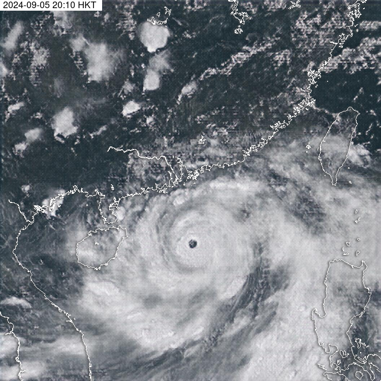
Fig. 3 As conventional visible images are not available during nighttime, “All-day Visible” satellite images generated using a deep learning method can be used to enhance weather monitoring at nighttime. The image in the figure shows “All-day Visible” image at around 8 p.m. on 5 September 2024 which is useful for analysing the spiral cloud bands of Super Typhoon Yagi.
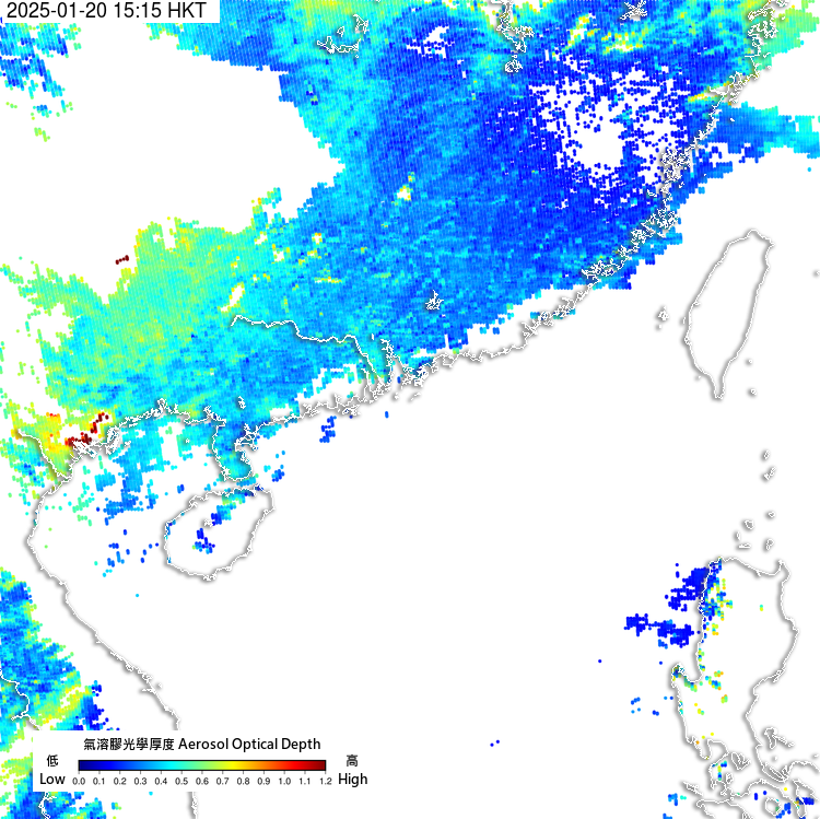
Fig. 4 Aerosol optical depth image from the Republic of Korea's GK-2B satellite helps monitor the visibility over southern China and the northern part of the South China Sea.